
Google Maps is indeed the best and most used map tool out there. Whether you are planning for your next road trip or simply looking for places, Google Maps got you covered. There are tons of features that make Google Maps special and viewing county lines is one of them.
Did you know that you can view county lines on Google Maps easily? At times, we might want to see the county line to see or know the county border within a state. Google Maps will help us in this situation.
If you want to view County Lines on Google Maps then follow the article given below. In the end, you also find details on how to embed a county line map as well.
You can view county lines on Google Maps on the web version of Google Maps as well as Android & iOS Mobile apps too.
How to View All Counties in Google Maps
At first, let’s see how to view all counties of a state at a single glance. If you wish to see individual county lines and borders then move to the next section of the article.
We are basically using a Google Maps search operator to view county lines. So follow along.
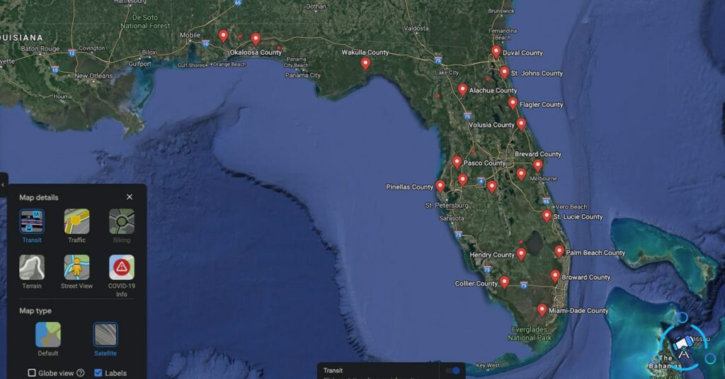
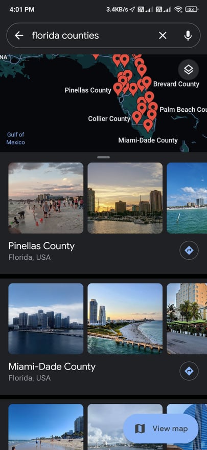
In order to view all counties within a state, all you have to do is just search for the state name followed by “counties“. Make sure to type “Counties” to the end of the state name without the quotes.
Executing the search will display all the counties within the given state. For example, if I want to find the list of counties in Florida, all I have to do is search for Florida Counties on Google Maps.

To the left section, you will find the list of all counties within the given state. And on the map, you will find the marker to all counties. Clicking on either the marker or county name from the left section will show further information about that specific county.
This is how we use Google Maps to view County Lines and view all counties within a state.
How to View a Single County on Google Maps
If you are looking for information related to a single county only then follow the steps given below.
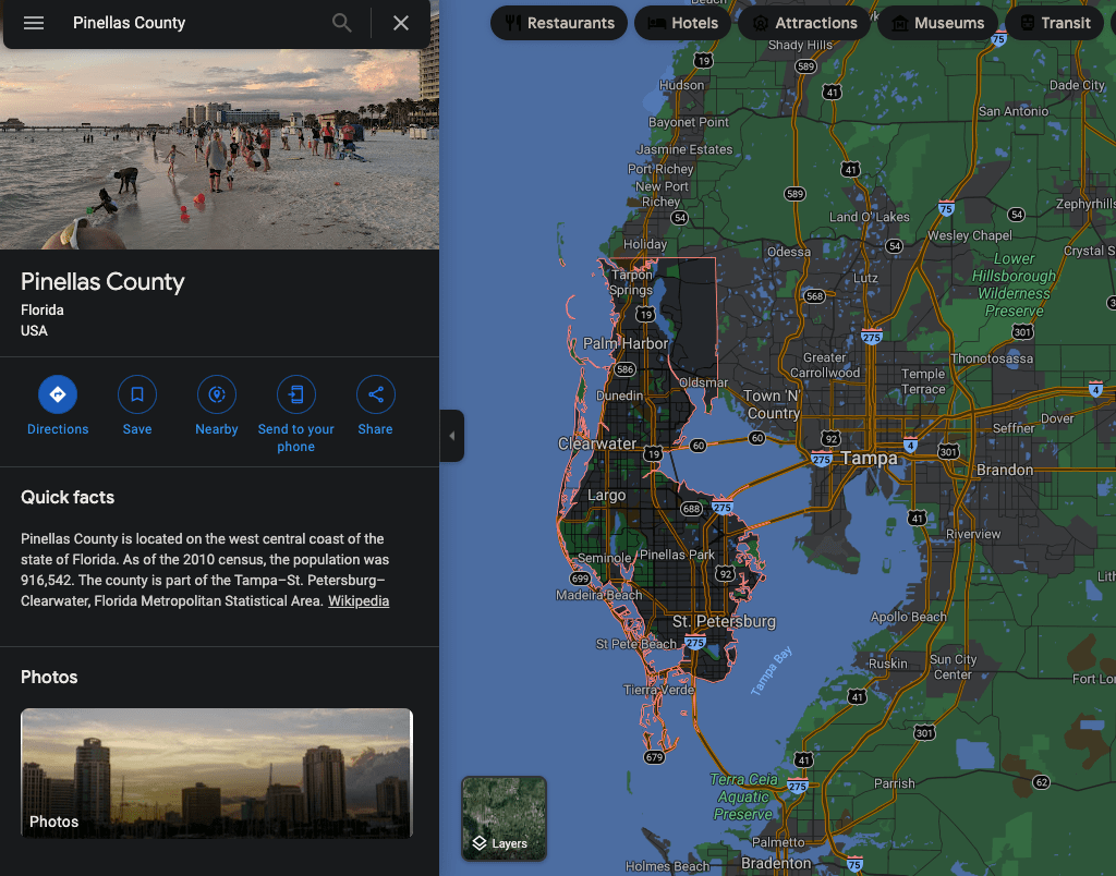
To view a single county, all you have to do is just search for the county name and then make sure to add “county” to the end without the quotes.
Executing the search will show details about that specific county and the county line will be displayed on the map on the right side as well.
This is how we view a county line on Google Maps easily. The same search commands can be used on the Google Maps Apps as well.
Share Maps with County Lines
If you wish to share the map you just saw, Google Maps got you covered. The Share or Embed option on Google Maps will let you share the map with county lines or shown county with others.
To share:
- Open Google Maps
- Search for a county or all counties within a state
- Once found, click on the hamburger icon from the top left corner
- Click on Share or embed Maps option
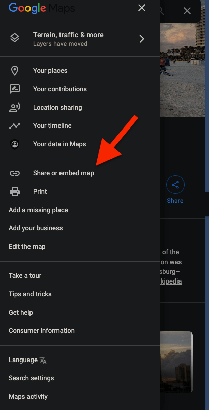
- A pop up will appearing displaying the link to the map that you just saw
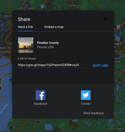
- If you want to get the code to embed the amp then switch to Embed a map tab and compy the embed code by cliking on the COPY HTML button
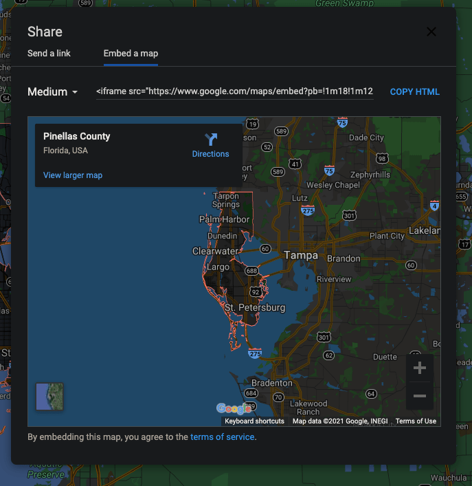
Once copied, you can either send the link to the map to anyone you want or embed the map on a webpage using the HTML code that you just copied.
Also, see how to view your location history on Google Maps and Removing Labels on Google Maps.
Show County Map on Google Maps
This is how we show or view county maps on Google Maps. The best part is that you can view the county map on the web version of Google Maps as well as the Google Maps app as well. Next time onwards, if you want to view the details like county lines or a list of all counties in a state along with their borderline then make sure to follow the steps mentioned in the article above.